
Réunion Island braced for impact as Cyclone Garance approached, triggering a series of weather alerts and impacting daily life. The storm, initially a tropical storm, intensified into a cyclone, prompting authorities to issue increasingly severe warnings to residents.
From Orange to Purple: The Alert Levels
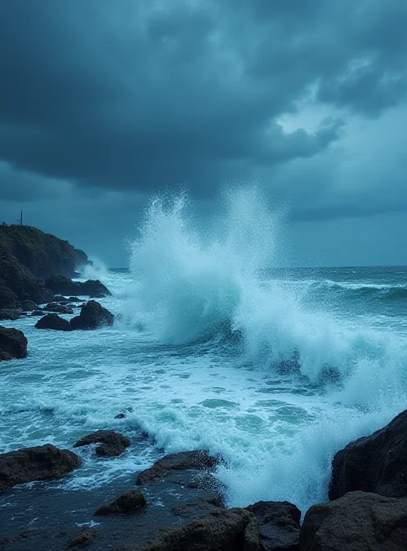
The progression of alerts began with an orange cyclonic alert issued on Wednesday afternoon, February 26th. This initial warning led to the closure of schools across the island. The approaching storm was projected to pass within 70 kilometers of La Réunion on Thursday. As Garance intensified, a red alert was raised, anticipating gusts exceeding 150 km/h, heavy rainfall, and significant swells. Météo-France described the approaching system as "dangerous," highlighting the potential for significant disruption.
The situation escalated further when prefect Patrice Latron announced a purple cyclone alert, driven by the threat of wind gusts exceeding 200 km/h. This highest level of alert required residents to take immediate shelter and prepare for the most severe conditions. "One observes on average an impact of a tropical cyclone on Réunion every ten years," according to meteorologist Emmanuel Wesolek, underscoring the relative rarity and seriousness of the event.
The Eye of the Storm and the Return to Red
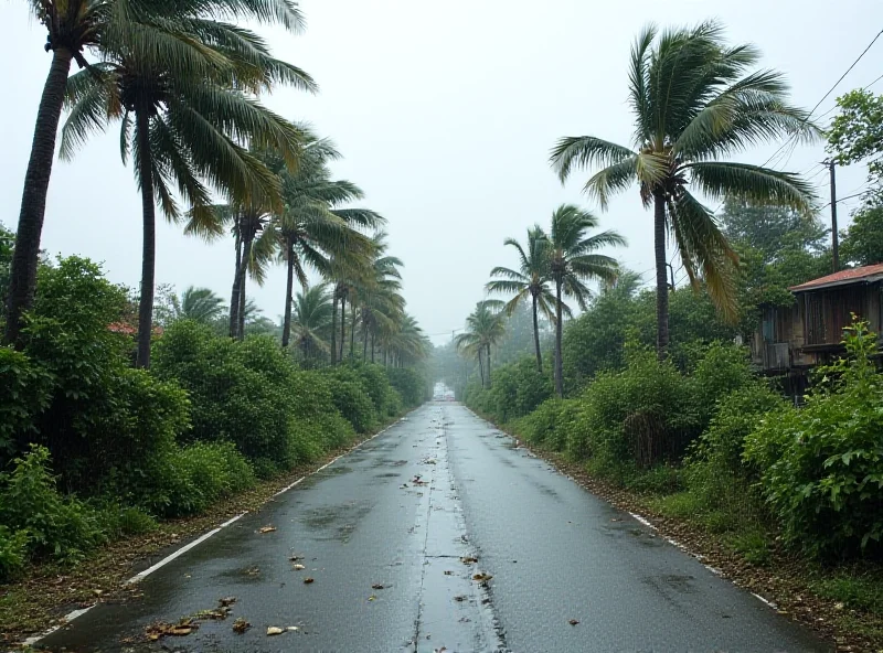
Fortunately, the purple alert was eventually lifted, and the island returned to a state of red vigilance. While the immediate danger lessened, authorities remained cautious, urging residents to remain vigilant as the storm continued to impact the region. The prefecture announced that, if the cyclone maintained its trajectory, it would pass "less than 50 kilometers" from the land, emphasizing the continued threat of strong winds, heavy rains, and significant swells.
Looking Ahead
As Cyclone Garance moves away from Réunion, the focus shifts to assessing the damage and beginning the recovery process. The island's rugged terrain is expected to play a role in weakening the cyclone as it continues its path. The experience serves as a reminder of the power of nature and the importance of preparedness in the face of extreme weather events.
"Garance is expected to become a cyclone on Wednesday and its peak intensity is predicted for Thursday, 'in the late afternoon, or even in the evening,' according to Météo-France, which describes the approaching system as 'dangerous.'"
The impact of Cyclone Garance will be felt for some time, but the resilience of the people of Réunion will undoubtedly help them to overcome the challenges ahead.